Tourello in detail – with real screenshots and videos from the apps.
What Tourello brings
More than a line to follow
Tourello answers the questions you really have before a tour: How hard is the trail? How long will it take me? Does the summit still get sun at four? Is the lift running tomorrow?
Three apps, one storage – including the Mac
Android, iPhone, iPad and a native Mac program work on the same tours, points and pace profiles. What you record on the way is waiting on the big screen in the evening.
Other modern outdoor apps have no program of their own for the Mac, and 3D is often only available in the browser or with a subscription.
Your data in your storage
Tours and points live on your own server (WebDAV, e.g. Nextcloud or a NAS), in Dropbox, in Google Drive or only on the device – as plain GPX files in folders. No account, no lock-in.
Truly offline
Not just the map: place search, routing, elevation profile, 3D terrain and the sun calculation all come from the downloaded region. Everything is computed on the device.
Sun and shade with real terrain
Does this spot get sun on 21 December – and when? Tourello computes the horizon from terrain up to 40 km away and even from nearby buildings. Plus the moon with its phase.
3D map and flight video
One button and the map stands up in 3D – with your plan, tours and points. Fly along any tour and save it as a video; on the Mac also as a short clip for Reels or YouTube.
Aerial imagery from mapping agencies
For every tile the sharpest service, from 5 cm in Brussels to 40 cm on the Faroe Islands – in Germany, Austria, Switzerland, Italy, France, Spain, Portugal, the Benelux, Poland, Czechia, Slovakia, Slovenia, Estonia and Cyprus, flat and in 3D. Where exactly
Ski days with lift times and lift status
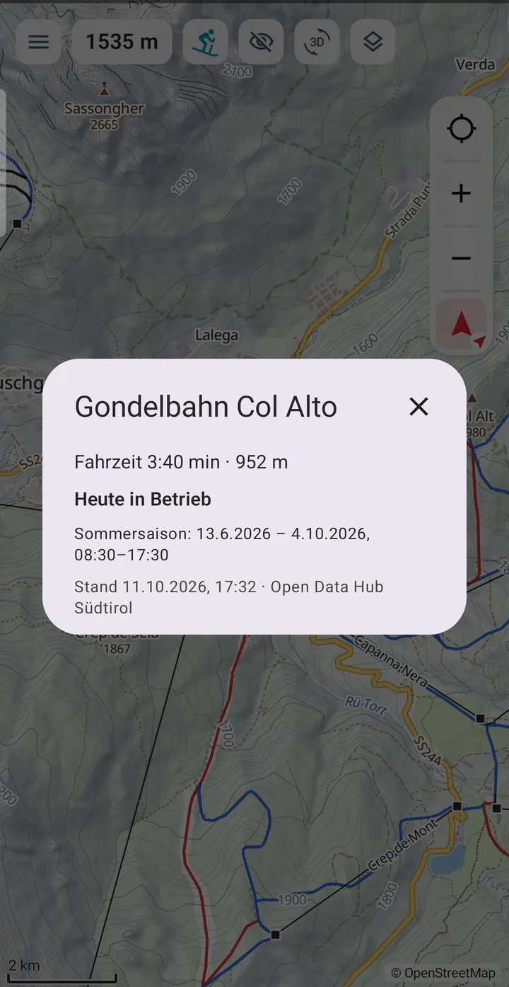
Plan over pistes (downhill) and lifts (uphill), ride time per lift, pace per piste colour. Closed lifts are shown dashed and avoided – even for a day next winter.
Walking times that fit you
Out of the box per DIN 33466, the German Alpine Club and Naturfreunde – or measured from your own recordings, by gradient, surface and difficulty. The typical error dropped from 20 % to 9 %.
Geotag photos on the Mac
Camera pictures – RAW too – get their position from your recording. Tourello checks the camera clock first and suggests a time zone or correction.
Six map profiles
One map for every way of being outside
The profile at the top left decides everything at once: map style, routing, walking time and which paths count as difficult. An "S3" trail is an ordinary path on foot – and a warning on a bike.
Hiking and mountaineering
SAC scale in routing: choose "up to T3" or "up to T4" – no alpine route slips into your plan by accident.
Walking time per DIN 33466 or from your own measured pace.
Marked routes such as Munich–Venice, Tour du Mont Blanc, GR 20 or the Walker's Haute Route Chamonix–Zermatt: tap and import as a tour.
Huts, peaks and passes found offline – with elevation and distance.
Sun on the summit: pictured, the Zugspitze on the shortest day – sun from 7:48 to 15:59.
Mountain bike, trekking and city bike
Colour = rideability: the MTB map colours trails by MTB scale (S0–S5), the cycling map by rideability for a trekking bike.
Line = surface: tarmac, gravel and singletrack at a glance.
Difficult sections are listed by kilometre before you get there.
Pace per German Alpine Club (MTB) or Naturfreunde (cycling) – or measured separately for a bio bike and an e-MTB.
Ski – piste and lift rarely found
Plan over pistes and lifts: pistes only downhill, lifts only uphill – the way a ski day really works.
Lift time from the map: the lift's ride time instead of a guess from elevation.
Lift status (currently South Tyrol and the Dolomites): closed lifts dashed grey, planning routes around them.
Aerial imagery under the pistes – flat and in 3D, pistes and lifts stay on top.
Any planning date: plan your winter tour in summer.
Tap a lift for ride time, length and season; a piste for number, colour, grooming and floodlight.
Winter simulation: snow instead of green meadows, muted aerial imagery – flat and in 3D.
Slope angle from 30° as a layer, with the slope at the crosshair – shows steepness, not avalanche danger.
City and car
City: streets, stops, metro stations and buildings in 3D – for the journey and the day after the tour.
Car: offline road routing to the car park at the trailhead.
Switching costs nothing: all profiles use the same downloaded region.
3D flight
Fly any track in 3D – planned or recorded rarely found
Tourello simulates your tour in the terrain: the camera flies along the line, with aerial imagery, path network and names.
Before the tour: fly your own plan – where does it get steep, where does it cross the ridge, how far is the hut?
After the tour: relive the recording and save it as a video, on the Mac also as a short video for Reels.
Any track: imported GPX files and tours from the archive too.
3D flight Zermatt – Hörnli hut below the Matterhorn: aerial imagery from swisstopo, path network and names from Tourello’s own map – recorded frame by frame on the Mac
Slope angle
How steep is the slope?
A layer colours everything from 30° in four steps – flat and in 3D, computed offline from the terrain of the loaded regions. The crosshair shows the slope next to the elevation.
Four steps: 30–35°, 35–40°, 40–45° and over 45° – the limits avalanche bulletins name too.
Legend as a small icon – a tap shows the steps, otherwise the map stays clear.
Shows steepness, not avalanche danger – that is in the avalanche bulletin.
Großvenediger in 3D with aerial imagery and slope angle, rotated on the Mac
Planning
Routes on the device – no connection needed
Crosshair on the start, set a point, carry on. Tourello finds the way in between with the proven BRouter engine – offline, on the device. Length, elevation gain, difficulty and your walking time appear at once.
Per leg its own profile: hiking, MTB, cycling, car, ski or straight line.
Move points by dragging, in 2D and 3D.
Turn instructions are saved with the tour.
On the iPad
The big map for hut and sofa
The iPad does everything the phone does, on a big screen: planning on the terrain, the stages of a multi-day tour, sun and moon, navigation – pictured, the Walker's Haute Route from Chamonix to Zermatt, stage La Sage – Cabane de Moiry, with swisstopo aerial imagery.
Elevation profile with difficulty under every stage – red is T3 and above.
Plan in 3D: set and drag points right on the slope.
The same storage as phone and Mac – the tour is the same everywhere.
Sun and moon
When does the sun clear the ridge? rarely found
Pick a day – Tourello scans the terrain in 180 directions up to 40 km, accounts for earth curvature and refraction, and shows to the minute when a spot gets sun. In town, buildings count too.
Ring around the point: where the sun comes from and where mountains block it.
Time slider across the day with sun, twilight, night and moon.
For photographers, winter tours and hut terraces.
Time & break planning
When should I start? rarely found
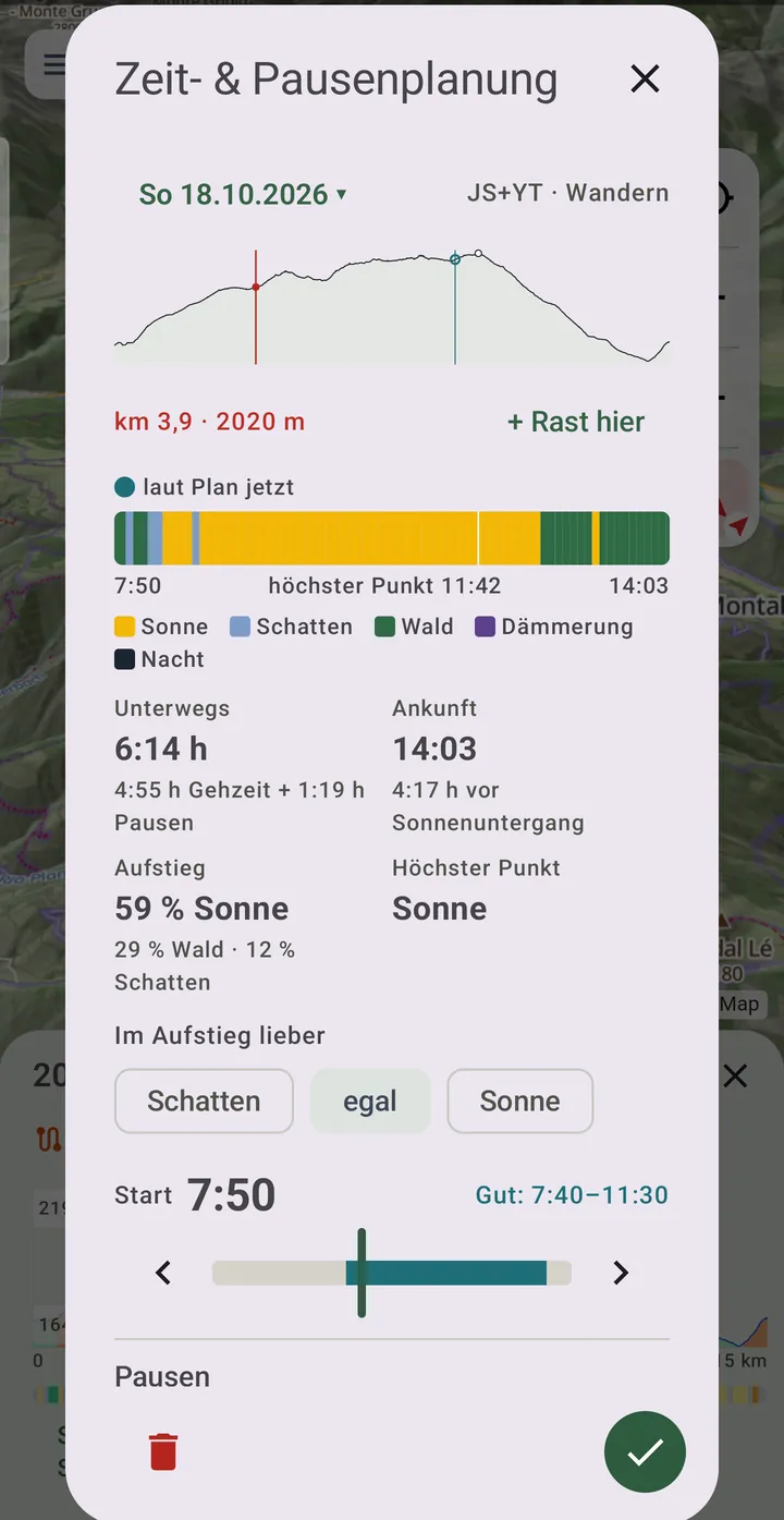
Pick a day and a start time – Tourello works out from your pace and your breaks when you will be where, and shows for every point of the tour whether sun, shade or forest awaits you there. And whether you arrive before sunset.
Start slider with a rating: every start from 5 to 12 o’clock – works, possible or too late.
Breaks measured from your own tours, plus rests at a hut or summit.
Plan on the Mac, take it along on the phone – the plan is stored in the tour.
On the Mac
The desk for your tours
On the big screen you plan, organise your archive, geotag photos and turn a tour into a video. All with the same maps you use outside.
Archive with folders, search and filters by length, climb and duration.
Multi-day tours with a description and a roadbook for every stage.
Geotag photos – RAW too, with a camera clock check.
Short videos in 16:9, 9:16 (Reels), 4:5 and 1:1, texts in five languages.
A closer look
Famous places, in Tourello
Every picture is a real screenshot from the apps – with the maps you download yourself. They show the German interface; the apps also speak English, French, Spanish and Italian.
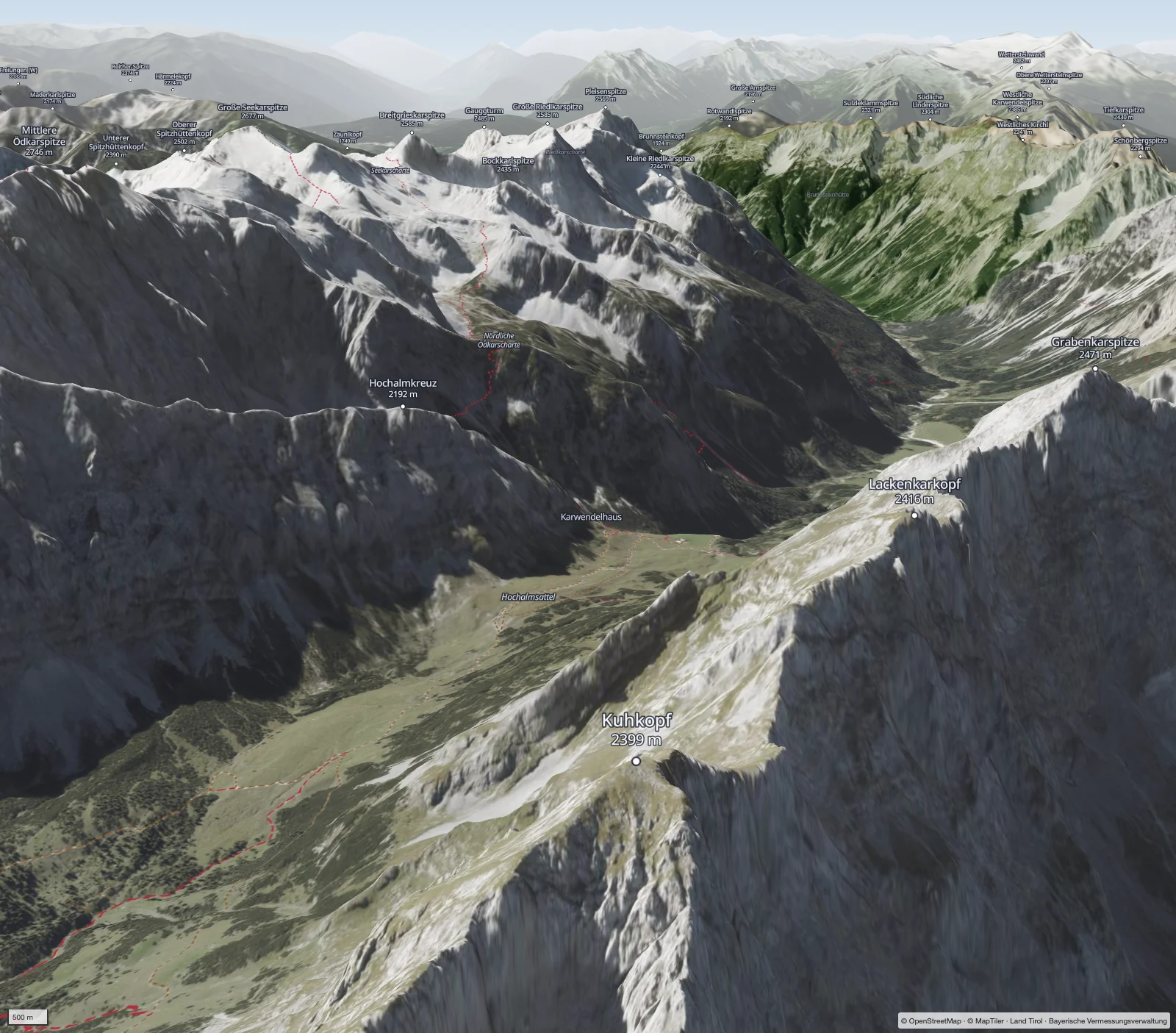
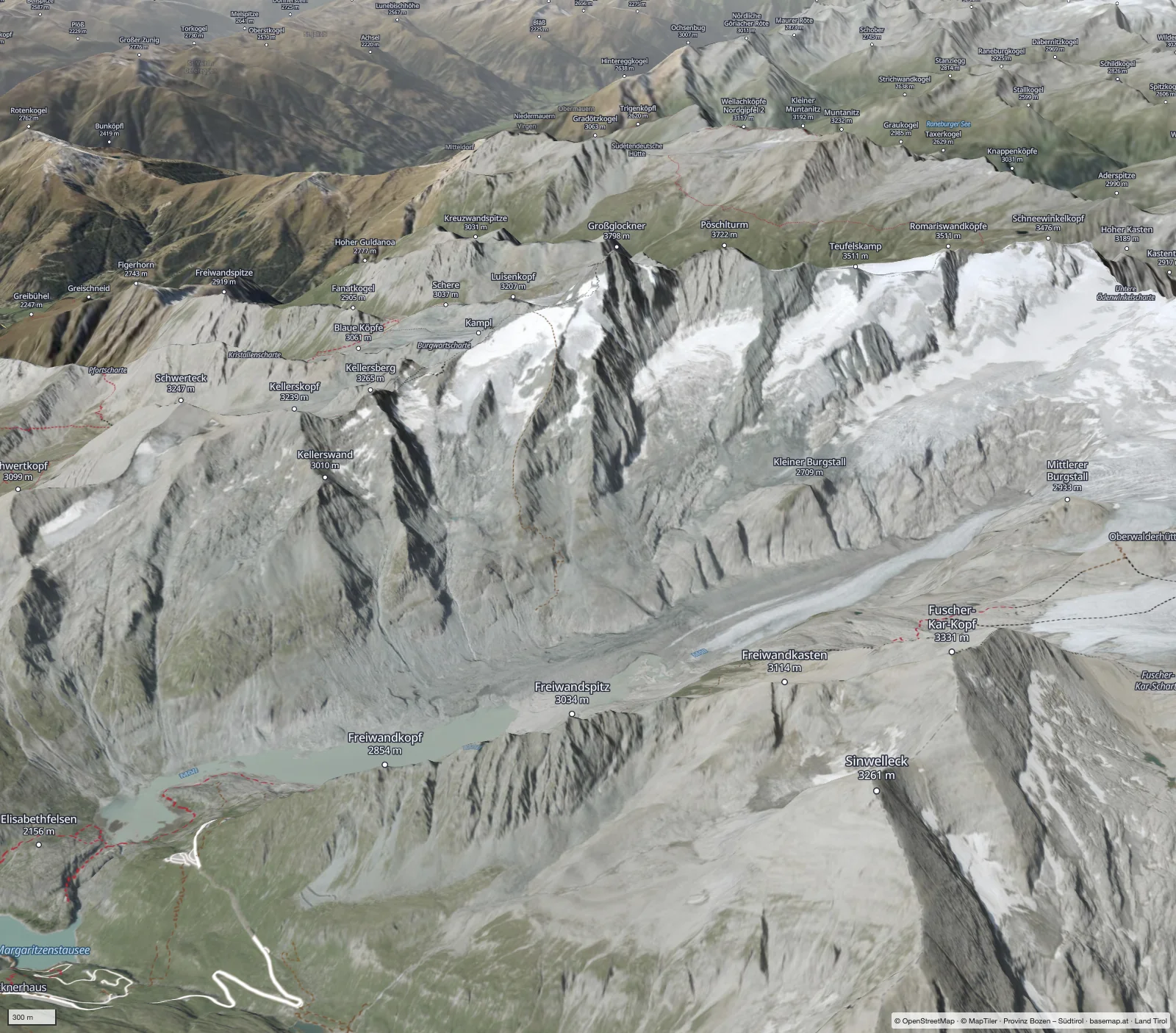
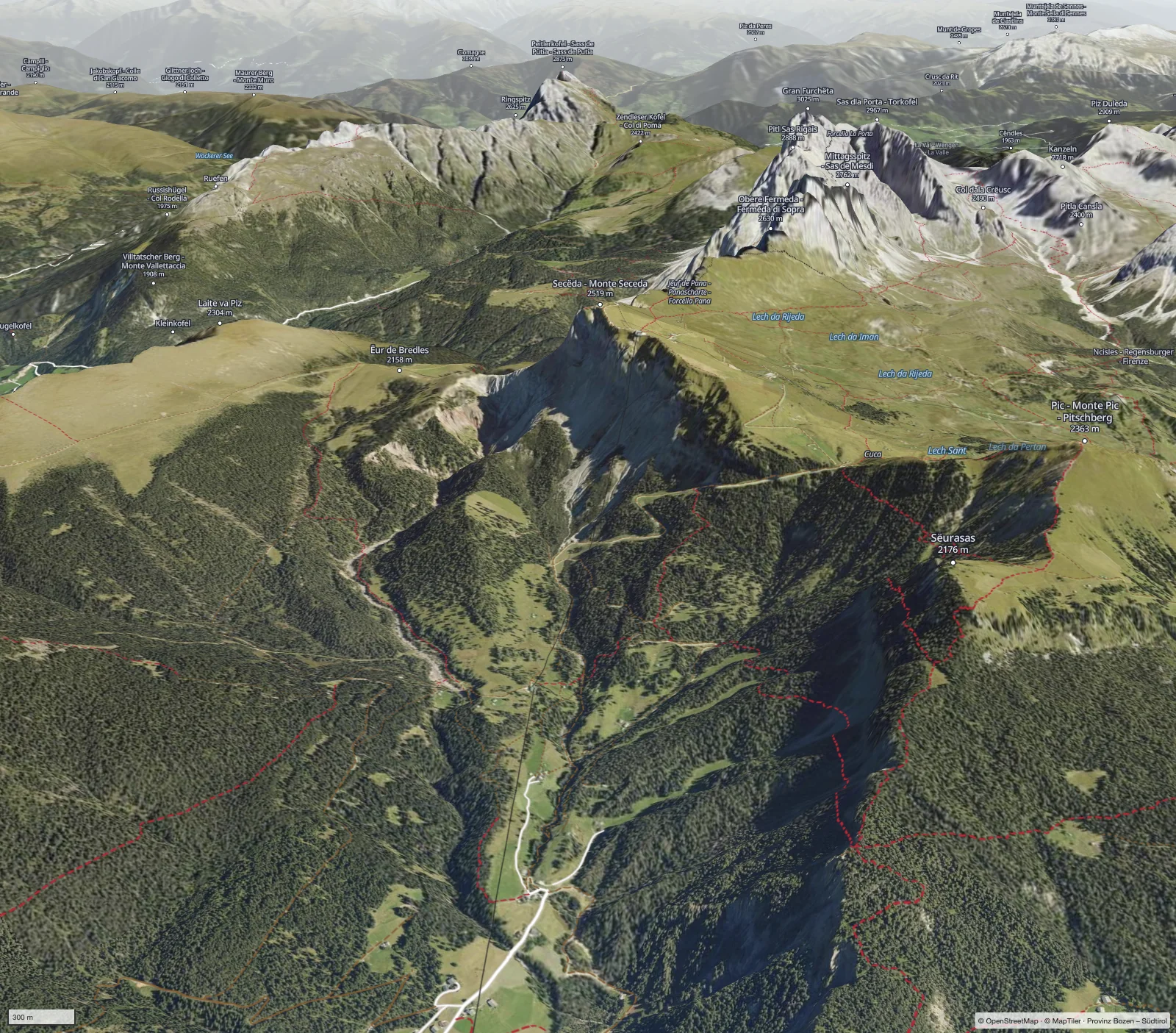
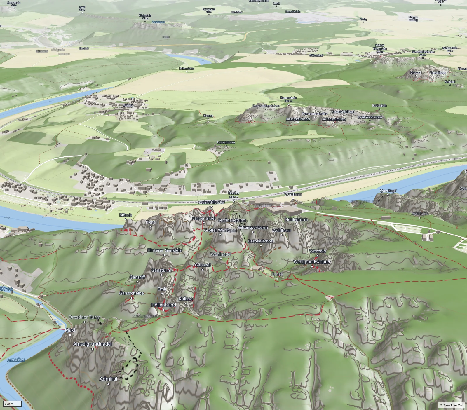
MatterhornHiking map in 3D, seen from ZermattEiger, Mönch, JungfrauFrom the Kleine Scheidegg to the Eiger north faceCapu Tafunatu, CorsicaThe rock arch above the Golo valley on the GR 20, aerial imagery IGN FranceKarwendelThe Karwendelhaus on the Hochalmsattel, the Birkkarspitze behindSchlegeis reservoirZillertal, with the Olpererhütte and FriesenberghausMont BlancAbove Chamonix, closing in on the glaciersWatzmannAbove the Königssee, with the paths to the WatzmannhausGroßglocknerWith the Pasterze glacier and the paths to the Franz-Josefs-HöheSecedaVal Gardena, the paths below the Geisler peaksNeuschwansteinHiking map in 3D with buildings, the paths to the Pöllat gorgeBastei, Saxon SwitzerlandHiking map in 3D, rock towers and paths above the ElbeZugspitze on the phone3D with aerial imagery, from Ehrwald up the Stopselzieher
Features in pictures
How you work with Tourello
Short videos and screenshots from phone, iPad and Mac – what the apps can do, on real tours.
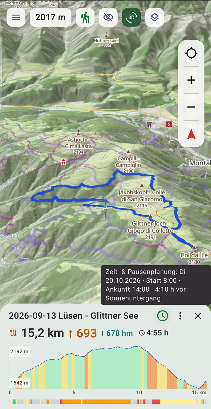
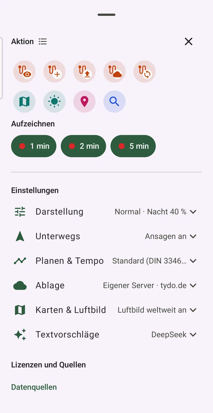
Planning on the MTB mapBadia – Villnöss: point by point, the route follows the MTB trails, then the elevation profilePlanning in 3D on the iPadA loop at the Lamsenjoch in the Karwendel: place points, turn and zoom in betweenNavigationFollow the route, stray off – Tourello recalculates, the old line turns greyTime & break planningZinal – Gruben: move the start until the climb is in the sun, then set a restSkiing in 3DKronplatz in the winter simulation – a tap on a piste shows its colour and stateLight on 21 DecemberHallstatt at 11:35 – barely half an hour of sunLine by difficultyLüsen – Glittner See, green to red by pathPath statisticsDifficult sections, surface, SAC and MTB scaleDownload regionsAlps, Bavaria, Austria, Switzerland, Alsace, Corsica and more – with the space they needOffline searchPeaks, huts, towns and addresses without a connectionEverything in one menuActions, recording, settings
Tourello is in testing
We are looking for people who spend a lot of time outside and say honestly what is missing. Tell us which device you use and where you go.